نظارات واقية للدراجات النارية
وفر 34%! اشترِ نظارات واقية للدراجات النارية بسعر 190.08 د.ل فقط في ليبيا. متوفر
🛒 تسوق الآنLibyan university professors specializing in water and agriculture will soon gain hands-on expertise in geographic information systems and remote sensing technologies through a new training service provision initiative launched this week.
The program, organized by Expertise France, will deliver up to 20 days of intensive training spread across a four-month period. It directly targets professors from water and agriculture departments at Libyan universities.
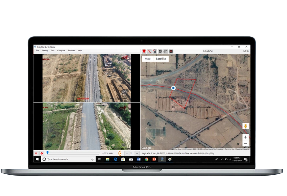
The training service provision focuses on equipping Libyan university professors with practical skills in geographic information systems and remote sensing applications. These technologies are essential for modern water resource management, agricultural monitoring, and environmental assessment.
According to the official posting, the mission aims to strengthen academic capacity in geospatial sciences. The training curriculum is designed to address real-world challenges facing Libya's water and agriculture sectors.
NASA's Applied Remote Sensing Training Program has long demonstrated that remote sensing data can transform decision-making in agriculture, disaster response, and ecological conservation. The Libyan program follows this proven international model.
Libya faces severe water scarcity and agricultural challenges that make geospatial technology training increasingly critical. The country relies heavily on the Nubian Sandstone Aquifer System, and precise monitoring of water resources through remote sensing can support more sustainable management.
Professors trained through this program will transfer knowledge to hundreds of students annually, creating a multiplier effect across Libya's academic and professional sectors. This capacity-building approach addresses a critical skills gap in North Africa's geospatial workforce.
Expertise France operates across North Africa and the Middle East, delivering specialized technical training programs in partnership with local institutions. The organization has a documented track record in strengthening professional capacity across the region.
The selection of GIS and remote sensing as priority training areas aligns with broader international development goals for Libya. These technologies enable precise mapping of agricultural land, water infrastructure, and environmental changes that directly impact Libyan communities.
Qualified professionals interested in this training service provision can apply before the July 24, 2026 deadline. The program welcomes both male and female applicants through the H/F designation.
This initiative represents a concrete step toward rebuilding Libya's academic infrastructure and professional capacity in fields essential for sustainable development. For Libya's universities, it signals growing international investment in the country's human capital.
LibyaPress will continue to monitor developments in this training program and similar educational initiatives across the country.
— LibyaPress / Tech Desk
===END_ENGLISH===